Measurement of Wind and Temperature Profiles

Wind Met Mast
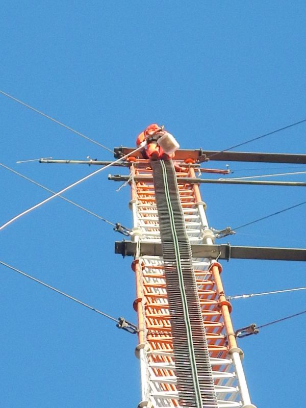
The SWE’s three-sided wind met mast with a maximum height of 120 meters has multiple booms at various, freely selectable heights. Meteorological sensors (atmospheric pressure, temperature, humidity, rain) and wind sensors (cup anemometers, wind vanes, ultrasonic anemometers) can be mounted on these booms.
In combination with the SWE data acquisition system the met mast’s equipment allows the measurement of load and power performance curves of wind energy turbines according to IEC standards 61400-12 and 61400-13.
Ground-based Remote Sensing
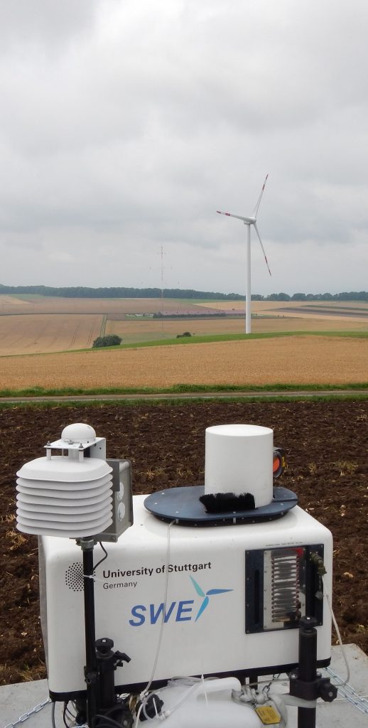
LiDAR – short range up to 250m
The SWE’s short range LiDAR enables a simultaneous recording of horizontal wind speeds and wind directions at up to ten different heights between 40 and 250 meters above the ground. In flat terrain this type of wind measurement offers a good alternative to conventional wind met masts. Further research is required for the application of the LiDAR technique in forested areas and complex or mountainous terrains. In combination with a SWE developed scanner , the LiDAR device can be employed on the nacelle of a wind turbine. By a certain systematic control of the laser beam the air flow can be observed and analyzed either in front of or behind the turbine covering the entire swept rotor area at various distances from the nacelle. The information about the approaching wind field for example is used for the development of predictive control strategies or future performance and load measurements. By observing a wind turbine’s wake an estimation of the loads on neighboring wind turbines within a wind farm can be done.LiDAR – long range up to 3000m
The SWE’s long range LiDAR enables a simultaneous analysis of air currents at different distances of up to 3000 meters from its location. By variable scanning mechanics measurements can be done within a hemispherical area around the device. As with the short range LiDAR-scanner, the laser beam can be steered in various, predefined directions.

Sodar
Surface-based remote sensing methods allow for a measurement of wind turbulence and temperature profiles in the atmospheric boundary layer with high vertical resolution (10 to 20 m). There are acoustic (SODAR), optical (windlidar) and electro-magnetic (RASS) techniques available. A SODAR gives vertical profiles of the wind and the vertical component of turbulence intensity and qualitative hints on the vertical structure of the boundary layer. A wind lidar gives essentially the same data but has a higher range than a SODAR and offers a much enhanced data availability. A RASS gives the same data as a SODAR but additionally gives the vertical temperature profile. All these instruments are available at IMK-IFU.
KITcube
With KITcube the Institute for Meteorology and Climate Research at the Karlsruhe Institute of Technology comes with an excellent equipment of modern measurement instruments for experimental study of the atmosphere. The instruments for ground-based remote sensing of the atmosphere (radar and lidar) and the instruments for in-situ measurements (turbulence, radiation, measurement towers) are used worldwide in large international field programs.
The KITcube is an overall monitoring system that consists of different instruments to probe the atmosphere. It can survey an atmospheric volume of about 10 km side length with different methods and thus allows the temporally and spatially complete capturing of all relevant processes. The KITcube is characterized by high operational flexibility. It can be operated as a mobile device at arbitrary measuring locations as well as in continuous operation for atmospheric monitoring.
The primary purpose of the KITcube is to deal with essential questions related to turbulence and convection in the boundary layer and to the triggering of deep convection and subsequent precipitation caused by moisture variability, moisture convergence, convergence zones and aerosol distribution. In addition, the meteorological measurement platform can make a contribution for example to determine the radiation balance or in combination with air chemistry observations to characterize atmospheric aerosols.


